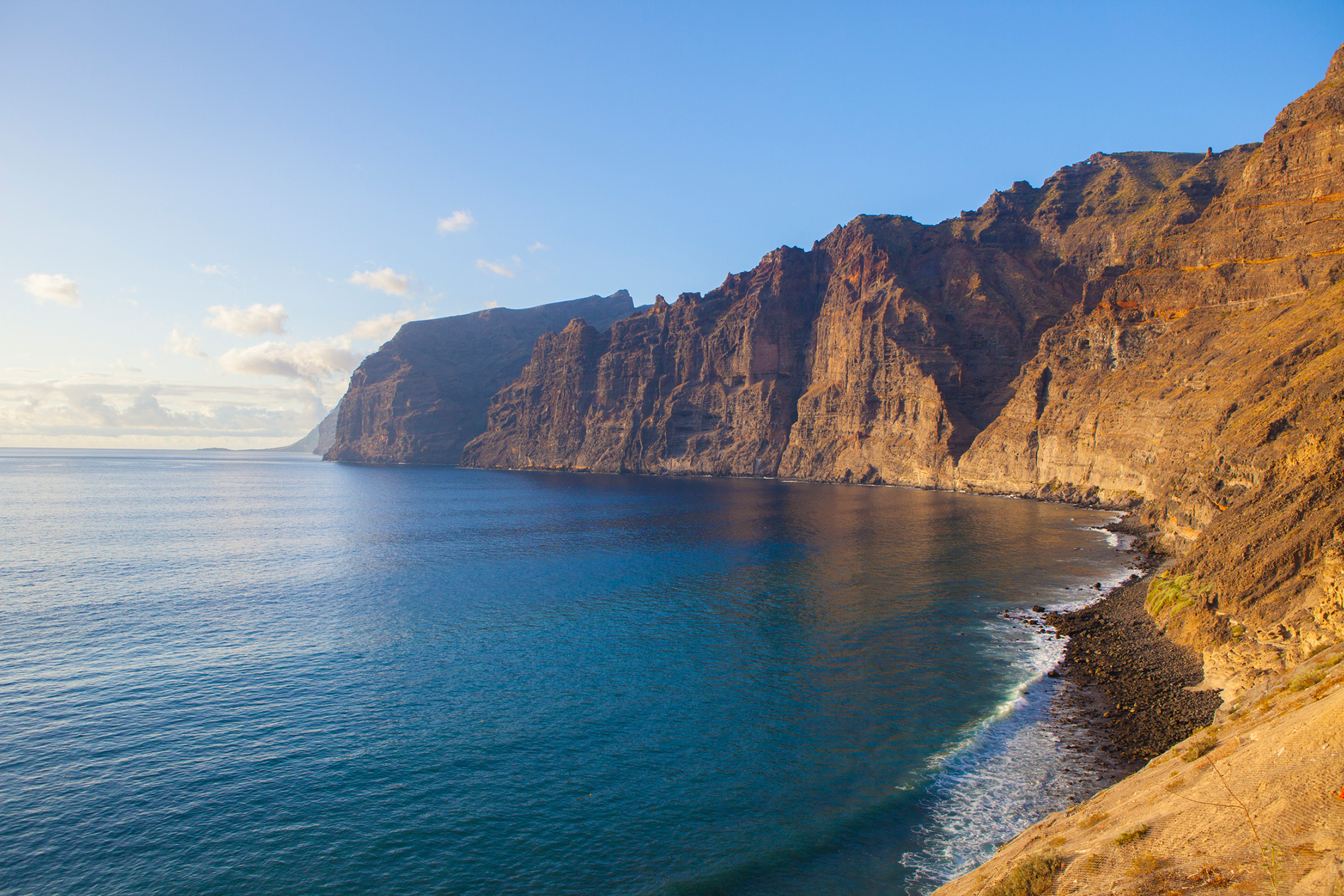
The Bosquecillo de Haría [Grove of Haría] is a recreational area on the Risco de Famara, in the municipality of Haría. With its wooden benches, natural stone barbecues and children’s swings, this area is also home to a unique treasure. The Mirador del Risco, just a few metres away, offers one of the most stunning postcard views of the island: to the east, 600-metre escarpments plunging down to the Playa de Famara, and an unbeatable view of the Chinijo Archipelago to the north. In addition, the prevailing trade winds and the frequent summer rains have led to the development of a remarkable ecosystem in the area, characterised by a high concentration of endemic animal and plant species. The climb from the village of Haría to this natural balcony is considered one of the best hiking routes on the island of Lanzarote.
The setting of El Bosquecillo
The El Bosquecillo Recreation Area, one of the few outdoor facilities purposely designed for family leisure in Lanzarote, enshrines a curious paradox. If you expect to find, as the name of the place suggests, a great number of trees, the sad reality is that all that remains of the original grove is its name. The area was replanted with dragon trees, palm trees and pines by the Granja Agrícola Experimental [Experimental Farming Project] a few decades ago, but it seems that the project was not enough to start a real forest. Nevertheless, there are plenty of other attractions to make a visit essential.
It is well known that the area where El Bosquecillo lies (considered to be one of the oldest parts of Lanzarote) was, in pre-Hispanic times, home to the largest settlements of majos—the original native inhabitants of the island—along with Zonzamas and Corral Hermoso. Its special microclimate, more favourable to the emergence of plant life than the rest of the island, has always made it possible to grow various types of crops.
In terms of scenery, words cannot do it justice. Stretching for 23 kilometres from Haría to Teguise, the Famara cliffs stand like huge walls lining the shore. They are the result of overlaying streams of lava laid down during the Middle-Upper Miocene (between 6 and 11 million years ago) which were gradually worn by coastal erosion into the form we see nowadays. “I have seldom seen anything more beautiful than these rugged grey, red and brown rocks, dressed in blue,” the English writer Olivia Stone said admiringly, as she travelled through Lanzarote in 1883.
A hike from Haría, taking in the fauna and flora
The village of Haría, being located in the centre of the valley to which it has given its name, is the departure point for many hiking trails. This is true of the trail leading to El Bosquecillo; this barely two-hundred-metre-long climb is accessible to almost anyone.
To the north-west of the group of low, whitewashed cottages rises a natural earth, zig-zagging path which leads to the point where we can begin to appreciate the remarkable beauty of the Valle de Haría—also known as the Valle de las Mil Palmeras [Valley of a Thousand Palm Trees]. During the moderate, twenty-minute climb, the plantations of vines, fig trees and pulses (all rooted in volcanic ash) inspire the visitor with respect for the hard lives of the local farmers of the past.
Fleeting panoramas of the Playa de Famara and of the island of La Graciosa appear at certain bends in the path, spurring the walker on—especially at those points where the climb suddenly becomes steeper. As the path climbs higher, the landscape takes on yellow and violet hues, thanks to the appearance of native plants such as Famara sempervivums, daisies and blue viper’s bugloss. Also in evidence is the wild olive tree (a cousin of the cultivated olive), the wood of which has been used since ancient times to make the wooden poles used in the conejero [i.e. traditional Lanzarote] sport similar to fencing.
A few steps into El Bosquecillo itself, and reached via a moderately steep slope, you can make out a strange golden spherical shape in the distance. This is the Acuartelamiento Aéreo Peñas del Chache [Air-Force Barracks], which stands at the highest point on the island.
Given the inhospitable nature of the terrain, visitors are always taken aback by the sight of wooden benches, stone barbecues and children’s swings. From here, it is impossible not to be struck, and then captivated, by the breathtaking postcard view of the cliffs, with the vast Playa de Famara in the background. In time, the eye becomes accustomed to the scene, and starts to pick out new tints and shades in the area’s panoramic views. To the north, the island of La Graciosa, along with its little sisters, Alegranza and Montaña Clara; to the south, the Valle de Haría clothed in palm trees; and to the west, the shifting dunes of Jable.
The ascent from La Caleta de Famara
Although the trail just described begins inland, another, equally interesting way of reaching El Bosquecillo is from the coast: from La Caleta de Famara, to be exact. The pretty houses of this fishing village with less than a thousand inhabitants spill out almost onto the beach of the same name. The small breakwater in the harbour boasts the best views of the cliffs, as viewed from sea level their 600-metre-high walls appear, if anything, even more impressive.
The ideal point of departure is from the estate of bungalows near the village. There are generally surfers in the area, taking advantage of the mild temperatures brought by the trade winds. But take care. Bathing is not advisable on this beach, due to the large number of sea currents.
This climb is not signposted and is very steep, making it far harder than the one described earlier.

