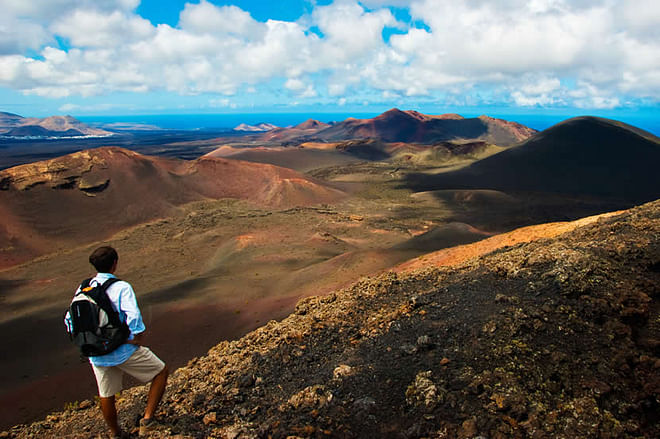
What makes the biggest impression on visitors to Lanzarote, even before the plane touches down on the island, is its spectacular island landscape. The amazing craters, the lava streams that run down to the ocean, the vineyards of La Geria… There is no doubt that, for lovers of excursions, Lanzarote is a kind of paradise. However, when it comes to independent hiking, you will find that access to the most remarkable spots on the island is restricted. This is the case, for example, with Timanfaya National Park.
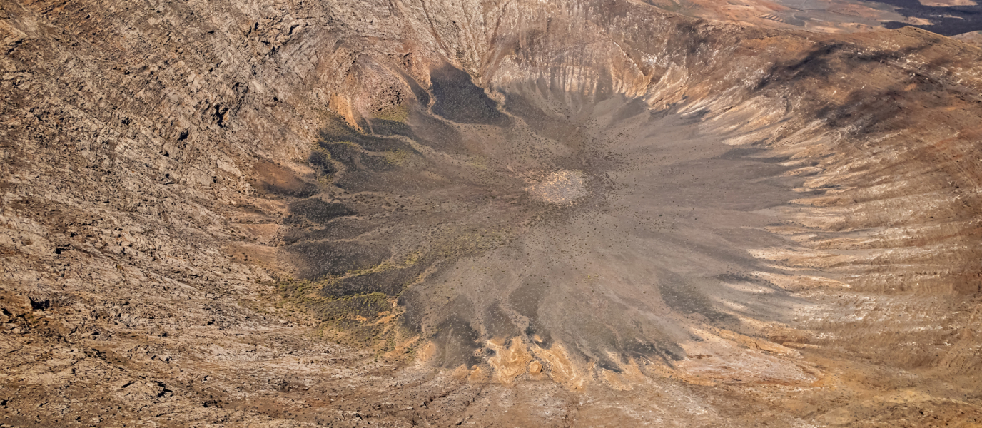
Luckily, Caldera Blanca is part of the Natural Park of Volcanoes (located in the vicinity of Timanfaya, but under another type of legal protection), so it can be visited without restrictions. That is why this is the ideal excursion for those who would like to explore the volcanic landscape under their own steam, and gaze into this remarkable crater. Starting to feel interested? That’s great! Below, we explain the route, step by step.
From Mancha Blanca to La Caldereta
Caldera Blanca is in the Tinajo district, a short distance from the village of Mancha Blanca. To arrive by car at the starting point of the route take the LZ-67 road, and then immediately take the dirt road called the ‘Camino del Cráter’. Once on this track, you will arrive within 5 minutes at a designated spot where you can leave the car. If you are approaching from Playa Blanca—in the south of the island—you must first cross the Timanfaya National Park. If the car park is full, the alternative is to return to Mancha Blanca, and leave your vehicle there. It does not make much difference, as a 10-minute walk will bring you back to the starting point.
The path leading to the volcano begins close to the car park, and zig-zags through a dark sea of lava. The surface of the path is made up of uneven, volcanic cobbles, so it is essential to wear suitable footwear. You cannot hike around volcanoes in flip-flops! Likewise, it is well worth carrying some water (you will not find a fountain along the path), something to eat, sunglasses, a cap or sun hat, and sun protection cream.
The path is clearly laid out and it is hard to get lost, unless you decide to leave the path and go wandering among the lava streams. This would be a huge mistake, not only because it would be extremely difficult to walk over the solidified lava but also because it would significantly increase the risk of getting lost. In addition, it would contribute to the destruction of the lichens that have taken root on the surface of the rock, the only examples of plant life in an area where the lack of water and the strong winds make for an extremely hostile environment.
After a walk of just over 1 kilometre—around 25 minutes—we get a taste of what awaits us at the end of the route. This is the volcano known as La Caldereta, which reaches 324 metres at its highest point. Without needing to climb the volcano (since the route takes us close to the highest point), we can get near enough to see its crater: 300 metres in diameter. A point worth noting is that this remarkable stretch of land, like the Caldera Blanca crater, was once used for grazing and farming. In fact, it is logical, taking into account the lack of water, that the islanders would take advantage of the few stretches of fertile land available (the concave form of the volcanoes facilitates the accumulation of rainwater) for productive work.
Hiking en Lanzarote: the ascent of Caldera Blanca
The route continues across the area that lies between La Caldereta and Caldera Blanca, which is also the area with the greatest accumulation of lava. The reason for this is very simple: the two volcanoes (La Caldereta and Caldera Blanca) constitute what are known as ‘islets’—in other words, thanks to their height, they were not affected by the eruptions of other volcanoes. We are referring specifically to the powerful eruptions that affected the south-west of the island between 1730 and 1736. The fact is that, during these eruptions, the flow of lava slowed down as it crossed the area between the volcanoes, thus causing this massive accumulation. Subsequently, the same area was affected by new eruptions.
During the ascent of Caldera Blanca, you can see the contrast between the dark colour of the sea of lava and the chalky whiteness of the skirts of the volcano. The presence of the lichens helps to heighten this contrast. In fact, the local place names have been determined by the colour of the mountain.
At last, the route emerges onto the upper reaches of Caldera Blanca, allowing us to admire the impressive crater, which is 1,200 metres in diameter. However, it is worth walking on to circle the summit until you reach the highest point, at 458 metres, when you can enjoy fantastic views of this volcanic island. On one side, you can see the town of Tinajo; on the other, the Timanfaya National Park. In the distance is the Chinijo archipelago, comprising the island of La Graciosa and the islets of Alegranza and Montaña Clara. The best views of this archipelago, however, are from the Mirador del Río, another visit not to be missed on Lanzarote.
As we walk around the summit of the volcano of Caldera Blanca, great care needs to be taken, as it is not uncommon to experience winds powerful enough to knock people off their feet. For that reason, it is better not to circle the peak if the weather conditions are unfavourable. After taking the opportunity that this unique spot offers for photographs of the extraordinary landscape, all that remains is for us to return along the same path that brought us here.
As you can see, this hike takes less than 4 hours, and is one of the best options for hiking in Lanzarote and for discovering some of the island’s most impressive scenery.

