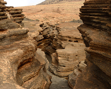
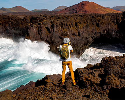
The imposing silhouette of the Volcán de la Corona, situated in the northern municipality of Haría, has presided over Lanzarote’s landscape for approximately 3,000 years. Responsible for the so-called Malpaís de la Corona—a sea of petrified lava that formed a rough and barren landscape—it shares the land with its two smaller siblings: the Volcán de la Quemada de Órzola and the La Cerca, Los Helechos and La Quemadita group of volcanoes. Due to the confluence of the basaltic landscape, owing to eruptions and the humid clouds brought on by the trade winds, this meandering area makes up a geomorphologic expanse of great interest and scenic beauty, with the presence of diverse endemic species. The nearby village of Yé, situated on the slopes of the volcano, is considered a perfect starting point for hikers wishing to see the crater and its views at an altitude of 600 metres. What’s more, the depths of the malpaís withhold gems as treasured as the astonishing volcanoes found on its surface. We are of course talking about the lava tunnels and the incredible sinkholes, which came about when the roofs of the cavities collapsed. Jameos del Agua and the Green Caves are just two examples of this tourist attraction forged over the centuries by nature. Declared a Natural Park in 1987 and reclassified as a Natural Monument in 1994, a visit to this special place will leave no one indifferent.
The birth of the Volcán de la Corona
If we go back in time over three millenniums, we probably wouldn’t recognise this unique landscape that today characterises the north of Lanzarote. Its notable wealth of plant life, in the form of highly diverse crops and an abundance of palm trees, make it difficult to imagine the vast eruptive phenomenon that over a period of months turned Haría into a sea of lava. Today the only visible traces are found in the aforementioned malpaís, whose blackish colour evokes the rivers of magma that the Volcán de la Corona poured in all directions, forever giving Lanzarote a distinct identity.
Once its plutonic activity had come to an end, amid the ashes emerged the elegant lines of a new volcanic cone, outlined with the form of a crown level with the Guatifay platform, very close to the Famara cliffs. It is known that, before the arrival of the Spanish conquerors, the majos—Lanzarote’s indigenous people—found the humid area to have favourable conditions for the cultivation of crops, and that people in the seventeenth century used it as a refuge from pirate invasions.
During the first third of the nineteenth century, the vicinity of the Volcán de la Corona once again took centre stage due to the introduction on the island of cochineal, a white and plump insect that lived on prickly pear plants, whose yield replaced the cultivation of sugar and grapevine that were in decline at the time. The parasite, known for its use as a red dye, revived Lanzarote’s economy from one day to the next as the European textile industry boomed. The prickly pear plants that had grown naturally on the slopes of the volcano for years gone by became cochineal farms worked equally by the hands of men, women and children.
A journey deep inside the volcano (from Yé)
The village of Yé is a small collection of houses whose white walls and green window frames are in perpetual contrast with the dark landscape that they are built upon. Just a few steps away from the church is a natural dirt track that leads through vineyards to the crater of the Volcán de la Corona. Throughout the 45 minutes that it takes to ascend, visitors will be able to see for themselves how the altitude—no more than 300 metres—alters the surrounding flora and fauna.
Although the landscape during the first half an hour is made up of an abundance of sand vines, whose scent alludes to the resultant malvasia wine, as it gets steeper coastal scrub start to appear, which are as characteristic as tabaibal (a mixed plant formation typical of the coastal areas of the Canary Islands), and as common as hawthorn, thyme, fennel and dockleaf. Prickly pear plants and almond trees also make an appearance along the route, protected from the Canarian trade winds by means of the semi-circular dry-stone walls called socos.
Things get yet more rugged during the last 15 minutes, where there is less vegetative cover but greater floral variety. Keep an eye out for the lichen that start to emerge stuck to the stone, as well as the purple orchilla, which was used on the island prior to the aforementioned cochineal as a textile dye. As you can see, Lanzarote’s history is closely tied to its nature.
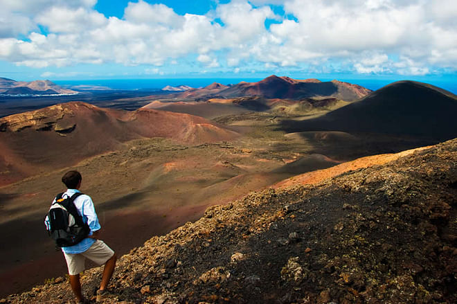
Close to the crater the wind begins to intensify and, as a result, it is here where visitors must take the most caution. From this point there are two options: to descend into the interior, experiencing the strange acoustics that its 190 metres of depth offer, or to continue on the ascent to the highest point of the volcano. The latter rewards you with spectacular views, both of the central part of the island and the malpaís in the south, and the Atlantic Ocean and the Chinijo Archipelago in the north.
A well-deserved rest at the summit is also a good time to discover two more things. On the one hand, if you focus your attention you will perhaps be able to make out, by tracing a straight line in the direction of Punta Mujeres, small fissures in the ground similar to caves. This is one of the underground lava tunnels that the volcano’s eruptions bequeathed the island, and which are at their most spectacular in Jameos del Agua and the Green Cave.
On the other hand, as Lanzarote is a key point along the migratory route of birds, the Volcán de la Corona is a perfect place to watch them. Thanks to the island’s proximity to the African coast, many of these birds choose the island as a place of rest on their long journeys. As a result, the presence of birds such as the spectacled warbler and Scopoli’s shearwater—the latter of which likes to build its nests in the malpaís—is common.

